
Coordinate geometry for land surveyors
The field calculations you do every day, on a modern Android phone.
Free. No ads. No account. No internet permission: your points never leave your phone.
Coming soon to Google Play
What makes it different
- Units surveyors actually use: metres, international feet, US survey feet, chains and links. Never a generic "feet".
- Bearings your way: azimuth, DMS, quadrantal (N45°30′E) and gradians. Type them the way your calculator does: 135.3029 is 135°30′29″.
- Every result is labelled with its unit and bearing convention, on screen and in every export.
- Refuses rather than guesses. If the inputs can't give a trustworthy answer, CogoBench says so instead of showing a plausible wrong number.
- Checked against the textbooks. Every calculation is tested against published worked examples (Ghilani, Mahun, NPTEL, the NGS State Plane manual and others) before release.
What it calculates
- Inverse and inverse lists: bearing, distance, ΔZ, one point to many
- Traverse: closed, link or open; bearings, angles right/left or deflections; angular and linear misclosure; Compass (Bowditch) or Transit
- Survey: shots from a total-station setup (angle, zenith, slope distance, HI/HT) saved as points
- Forward, midpoint, divide a line, three-point resection with a danger-circle warning
- Intersections: bearing–bearing, distance–distance, bearing–distance, line–line
- Area by coordinates, with every side's bearing and distance
- Point to line and alignments: station and offset along a chain of lines, offset lines
- Horizontal curves solved from any two elements, arc or chord definition, staking tables with coordinates
- Arcs through three points, spirals, and vertical curves with high and low points
- Level book: rise and fall or height of instrument, checks, misclosure adjustment
- Slope reduction, grade and slope, grid ↔ ground, lat/long ↔ UTM (WGS 84)
- Transform: rotate, shift, two-point or least-squares fit
- Bearing converter and calculator, and a to-scale plot of the job
- CSV import with a column mapper you confirm, and CSV export with units in the header
Screens
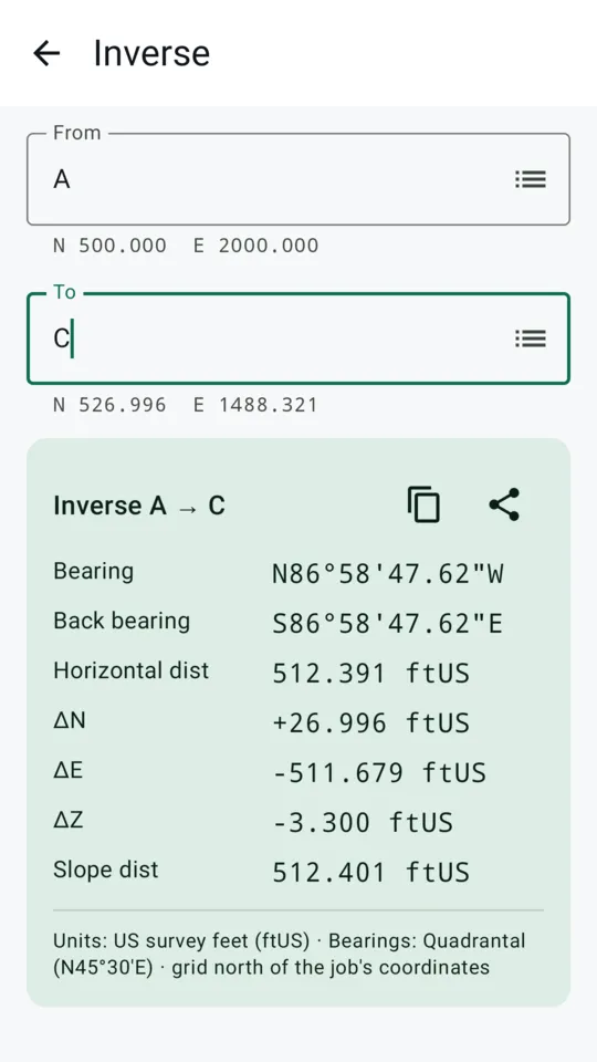
Inverse, in US survey feet 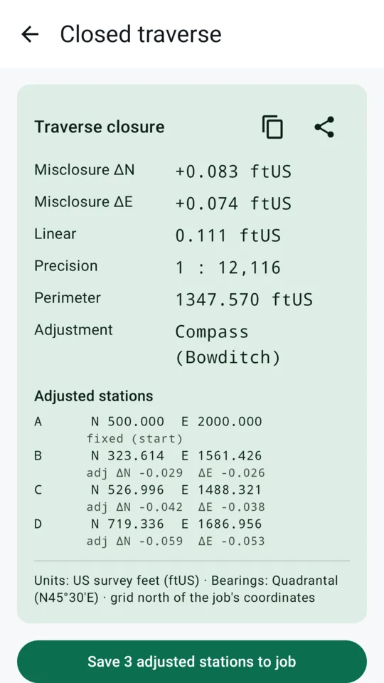
Closed traverse, adjusted 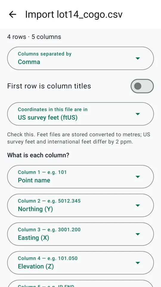
CSV import, columns confirmed
Support
Email hello@cogobench.com. For a wrong or surprising result, send the input values, the result you got and the result you expected (and where that came from, if it's a textbook or another program). In the app, Email support starts that email for you, with the app version, Android version and phone model filled in; you see all of it before sending.
Questions
- Does CogoBench send my data anywhere?
- No. The app does not have Android's internet permission, so it cannot reach a network. You can check this under "App permissions" on its Google Play page. See the privacy policy.
- Is it really free?
- Yes. The calculator is free with no ads and no account, permanently.
- Can I bring my points from another app?
- Yes, as a CSV file: from a data collector, CAD, a spreadsheet or an older COGO app. If you used Cogo Survey Pro, export your points to CSV and import them; CogoBench is an independent app and is not connected with it. The import screen shows how each column will be read before anything is imported, and remembers your choice for the next file of the same kind.
- Which phones does it run on?
- Android 7.0 and later. There is no iPhone version.
- Feet or US survey feet?
- Both, and they are kept apart: international feet (0.3048 m exactly) and US survey feet (1200/3937 m). Chains and links too. You choose your units and bearing style on first launch and can change them at any time; every result states which ones it uses.
- Can I rely on the numbers?
- Every calculation is tested against published worked examples, but CogoBench is a calculator, not a certified survey product. As with any tool, check the results that matter before you rely on them. If you find a result that disagrees with a trusted source, please email us. Wrong results are fixed before anything else.
- How do I suggest a feature?
- Email hello@cogobench.com and say how you would use it.